Northwest Control-Line Flying Fields
Where do control-line fliers gather to fly their model airplanes in the Pacific Northwest? Below is information about Northwest flying fields. This information is compiled by Flying Lines from reports by clubs and local fliers.
We'll update the information on flying fields as we receive it. If your flying field is not listed below, or the information is incorrect or changed, please e-mail the editor. Flying fields are listed alphabetically by metro area.
We have photos of some of the flying sites. If you can send a photo of a flying site that's missing below, please
Chehalis, Wash.
 Chehalis Airport: Get off I-5 at exit
79 (Chamber Way). Go west to intersection of Chamber Way
and N.W. Louisiana Ave. Turn left onto N.W. Louisiana Ave.
Follow that to first major intersection. Turn right onto
N.W. Airport Way. Follow that to Airport Entrance sign.
Turn right onto airport entrance road. Follow that approx.
1/4-mile to electronic gate.
Chehalis Airport: Get off I-5 at exit
79 (Chamber Way). Go west to intersection of Chamber Way
and N.W. Louisiana Ave. Turn left onto N.W. Louisiana Ave.
Follow that to first major intersection. Turn right onto
N.W. Airport Way. Follow that to Airport Entrance sign.
Turn right onto airport entrance road. Follow that approx.
1/4-mile to electronic gate.
Conditions of use are: Control-line model airplanes only. All flyers must have valid AMA licenses. Most CL modelers in the area have the gate code, however, contact the Northwest Skyraiders to get the code if you don't have it. Park on grass near the perimeter fence or on concrete taxiway next to grass. Do NOT park on asphalt taxiway in front of hangar S-1. Muffled engines preferred. All appropriate safety requirements listed by the AMA, such as wrist thongs, must be followed. Remember that we are guests of the airport using their property and act accordingly.
Faro Field: 1354 Pleasant Valley Road, Chehalis.
This is an RC field that also contains a control-line
circle. Email
for information or see the Faro Field
Flyers club website.
Snohomish, Wash.
 Snohomish Radio Aero Club:
Turn east off Interstate 5 at Everett into Highway 2
toward Monroe, Wash. Get off Highway 2 at Highway 9 and
turn left, north, onto Highway 9. Immediately across the
overpass turn right, east, onto Bunk Foss Road. Follow it
down the hill to the stop sign at Old Machias Road. Cross
Old Machias Road onto Richie Road for about 300 yards. The
field is on your left and the gate is at the intersection
of Richie Road and S. Machias Road.
Snohomish Radio Aero Club:
Turn east off Interstate 5 at Everett into Highway 2
toward Monroe, Wash. Get off Highway 2 at Highway 9 and
turn left, north, onto Highway 9. Immediately across the
overpass turn right, east, onto Bunk Foss Road. Follow it
down the hill to the stop sign at Old Machias Road. Cross
Old Machias Road onto Richie Road for about 300 yards. The
field is on your left and the gate is at the intersection
of Richie Road and S. Machias Road.
The circle is grass with a radius of 76 feet. The circle
is at the northeast corner of the site.
Conditions of use: AMA membership and club membership, which gets you the gate code. Guest visits are welcome. Control Line planes, only, on the circle.
Local control-line contact is Orin Humphries. Or see the club website.
Eugene, Ore.
Eugene Equipment Auction (formerly Can Do Ranch): The Eugene Prop Spinners fly at a privately owned ranch about five miles north of the Eugene Airport off Highway 99 at Milliron Road. Flying is allowed when a club officer is present to open the gate. Guests are welcome; all fliers must be AMA members and pay a $5 per flying session fee to cover the cost of using the field. E-mail the Eugene Prop Spinners for upcoming scheduled flying dates and directions to the field. The flying site includes one grass circle. Mufflers are recommended. The field is not open to the public on a drop-in basis.
Orchard Point County Park: The Eugene Prop Spinners have a permit to fly during the winter months at a Lane County park alongside Fern Ridge Lake, west of Eugene. Flying is allowed at the park from November through April when a club member is present to open the gate. Guests are welcome; all fliers must be AMA members and have a valid Lane County parking pass. Facilities include up to two grass circles, picnic tables and portable restroom. Mufflers are recommended. E-mail the Eugene Prop Spinners for upcoming scheduled flying dates and for information about how to get a discount parking pass. The field is not open to the public on a drop-in basis.
Directions to the site: From Highway 99 in west Eugene, take Clearlake Road west to Orchard Point County Park. The park has two entrances. The first entrance you come to, the north entrance, is closed to the public from November to April -- the Prop Spinners have the combination to this gate and use this entrance to get to the flying site. You also can use the south (marina) entrance, but it is a longer walk to the flying circles.
Medford area, Ore.
 Agate
Skyways CL Circle at Rogue Eagles
RC Club field: We share the same facilities as
the RC guys: sunshade, bathroom, picnic tables, etc. The
circle is “Field Turf” with pits and our own sun shades.
Circle is across the access road from the RC runway. There
is a locked gate that is left open when someone is flying.
Club members have the combination. There is someone flying
most days from 9 a.m. to 2 p.m. if the weather is decent.
Agate
Skyways CL Circle at Rogue Eagles
RC Club field: We share the same facilities as
the RC guys: sunshade, bathroom, picnic tables, etc. The
circle is “Field Turf” with pits and our own sun shades.
Circle is across the access road from the RC runway. There
is a locked gate that is left open when someone is flying.
Club members have the combination. There is someone flying
most days from 9 a.m. to 2 p.m. if the weather is decent.
Visiting pilots welcome, AMA required. Say “hello” to the
RC guys. Field is open from dawn to dusk, mufflers
required for large engines. Max 66-foot lines, 72’ radius
circle, 80’ plus clearance. Wind is generally mild with
minimal turbulence. Local contact is Jess Walls.
Directions to the site: From Medford, take Highway 62 north to Highway 140, turn right and drive 3.5 miles. Turn right on East Antelope Road, drive past Stone Ridge Golf Course, turn right into “Agate Skyways.”Map to site.
Portland, Ore.

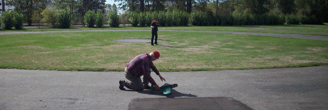
East Delta Park: From I-5 just south of the Columbia River, take the East Delta Park exit, #306b. Follow signs to East Delta Park, about 1/4 mile after exit. This will deposit you right at the control-line flying area. There is one asphalt circle and room for two or three grass circles.
Roseburg, Ore.
Church on the Rise:
Up behind the church there is a former baseball
field with ample parking adjacent to the field.
There is a 70+ foot radius grass flying circle with a
compacted gravel launch strip. Also adjacent to the
field is a covered patio with tables, chairs, fire pit,
electrical outlets and indoor restrooms. Down below
the grass field, beside the church, is a large, paved
parking area which will accommodate a 60-foot circle.
Directions to Roseburg Church on the Rise: The
address is 3500 N.E. Diamond Lake Blvd., Roseburg.
From I-5 take either downtown exit to Highway 138 East
(Diamond Lake Blvd.). In about two miles the church is
plainly visible on the left. To get to the grass
flying field, cross the church parking area, go through
the gate behind the church and up the little hill.
Questions? Lost? Bob Lewis cell phone: 541-537-0061
Sunshine Park: A city park
consisting of five baseball fields kept mowed
year-around and open to control line flying when not in
use for baseball. Public restrooms, bleachers,
electric outlets in central gazebo. Use the
main entrance for fun large groups and the lower
entrance normal flying days.
Directions to Sunshine Park: From Roseburg east
on Diamond Lake Blvd. (Hwy 138) -- All the way out past
Phoenix School and Les Schwab Tire warehouse. Normal
flying: Go past the main entrance to the baseball park
at Sunshine Park about 100 yards. Turn left at the
sawmill log yard entrance and go through the big yellow
gate. Turn left down through the chain link fence gate
into the baseball park. NOTE: For events or on days when
the log yard gate is locked we go in the main entrance
and fly up there.
Questions? Lost? Bob Lewis cell phone: 541-537-0061
Salem, Ore.
Bill Riegel Model Airpark: This field has one asphalt circle, one grass circle, and a storage building. It is right at the Salem Airport terminal. From Interstate 5, take exit #253, Hwy.22 / Mission St. SE / Airport and head West. Do NOT turn on Airport Road. Turn left on 25th Street (west side of airport) and left again right after the Hertz car lot. Parking can be done between the trees near the cut-de-sac.
Seattle, Wash., area
This site is no longer available for regular control-line flying as of late 2016 but is still used as a contest venue. Auburn Municipal Airport: Also known as Scobee Field. Vehicle entrance is at the southeast end of the airport, security card required, or the "man gate" at the south end next to the hotel. The gate has a cypher lock to enter from outside. Access is limited to Northwest Skyraiders and guests. Guests must be accompanied by a club member. AMA membership and mufflers or electric power is required. No flying before 9 a.m. or after 8 p.m. Contact a member of the Northwest Skyraiders for visits from out of town.
Riverwalk site, Kent: It is easily accessible from Highway 167, Willis Street Exit. Head West, take left onto West Valley Hwy./Washington Street, and left again. From I-5, take Kent-Des Moines exit, head East to West Valley/Washington St., turn right, then immediate left. Click here for map to Riverwalk site.
Tri-Cities, Wash.
TRAC stadium complex: This field at a baseball stadium serves the Richland-Pasco-Kennewick area. More information to come.
Vancouver, B.C. area

Upper Coquitlam River Park, Coquitlam, B.C.: This two-circle CL flying site at 1795 Pipeline Road, which shares a park area with a radio-control runway, is about 40 minutes from the U.S. border's Sumas crossing. Directions to the site starting from Lougheed Highway in Coquitlam: Turn north on Pine Tree Way, then right on David, then left on Pipe Line Drive. Go about two miles, just after the second gravel pit, to the flying site on the right.
Rice Mill Road site, Richmond, B.C.: If you are coming from the U.S., stay on #99, the Canadian extension of I-5, and go about 14 miles north of the border to the Massey Tunnel. Get in the right lane just before the tunnel. The tunnel goes under the river. You take the first exit after the tunnel to Steveston Hwy. Go left (west) on Steveston, over the freeway then take the first left onto No. 5 Road. The 3rd left is Rice Mill Road. About 400 yards down on the left is the flying site. Park beside the road with the other cars. This is due west of the (99) on the freeway on the map and about dead center in the map. At the U.S. border, usually "Truck Customs" is where the lineup is shorter. Watch for the sign as you approach Blaine. Once you are through Customs, go about a mile north on 172nd St (aka Pacific Hwy) and turn left at the first stop light, 8th Ave. This takes you back to the #99 freeway.
Flying Lines home page
This page
was updated Aug. 16, 2024